
Where to go and what to do in Jenner
Most of it is outdoors, most of it is free, and all of it is within a half-hour drive of the bridge over the Russian River. Jump to a section:
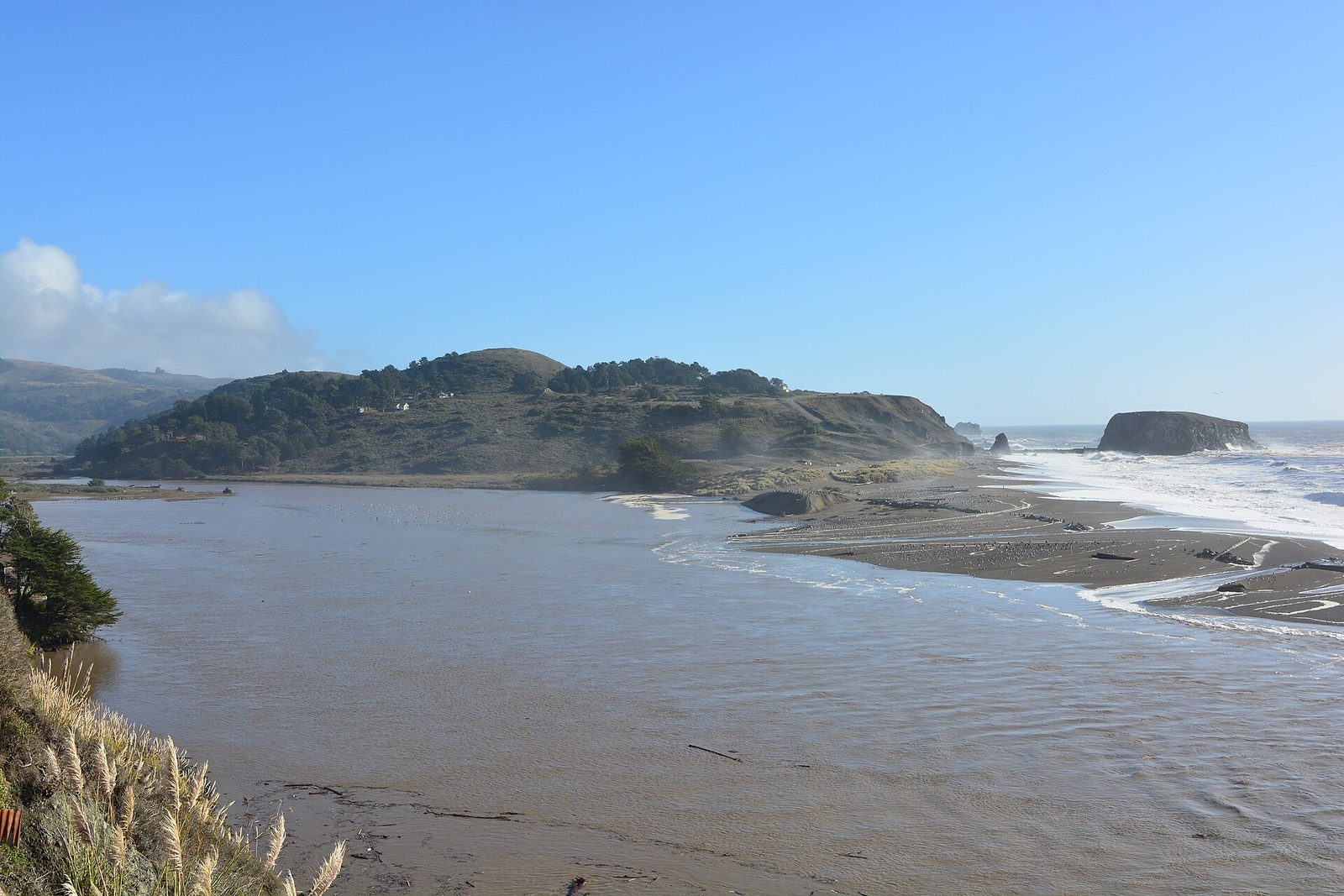
Wildlife at the river mouth
The estuary is the reason Jenner exists on postcards. Bring binoculars; the animals do not come to you.
Harbor seals at Goat Rock Beach
Pacific harbor seals haul out on the sand spit where the Russian River pours into the ocean. From the north end of the Goat Rock parking lot you can watch dozens of them loafing, swimming and, in spring, nursing pups. Volunteer seal watchers are often on duty on weekends with spotting scopes and will happily point things out.
Keep at least 50 yards away, stay behind any rope or sign, and never let a dog near the colony. Pupping season runs March through August; the colony is roped off and State Parks Seal Watch docents are on the beach at weekends. Day use is $10 per vehicle, and the gate closes when the ocean is dangerous.
Birding on the estuary
Brown pelicans skim the water in formation, ospreys fish from the snags, great blue herons and egrets stalk the shallows, and in winter the lagoon fills with ducks and grebes. The benches by the Jenner Visitor Center and the pullouts on Highway 1 just north of town are the easy spots. Early morning, before the wind picks up, is best.
Gray whale watching
Around 20,000 gray whales pass the Sonoma Coast twice a year: south to Baja from December to February, and back north with calves from March into May. Any high bluff works. Local favourites are the overlooks at the Jenner Headlands, the Goat Rock headland, Bodega Head (10 miles south, where Whale Watch volunteers set up with scopes on weekends from January to Mother's Day) and the Fort Ross bluffs.
Look for the spout first, a bushy puff that hangs in the air for a second, then the dark back and, if you are lucky, the tail.
Kayak the Russian River estuary
The last three miles of the Russian River are flat, sheltered and full of life, and you can rent a kayak or stand-up paddleboard right in the village. Paddle upstream with the incoming tide past Penny Island, watch seals pop up beside you, and drift back down. Two hours is plenty for a first trip; a half day gets you up to the Willow Creek beaches.
- Rentals and guided tours: WaterTreks EcoTours operates from the river bank in Jenner year-round with kayaks, SUPs, wetsuits, lessons and naturalist-led trips, including evening paddles. Hours shift with the weather, so call ahead.
- Go in the morning. The afternoon northwest wind can turn the paddle home into a workout.
- Stay away from the mouth. The river-mouth bar, the surf and the seal haul-out are off limits; the current there is dangerous and the seals are protected.
- Wear the life jacket. The water is cold all year, around 50–55 °F.
The beaches
Seventeen miles of coves and headlands between Bodega Bay and Jenner, all one state park. Day use is $10 per vehicle at the main lots; the roadside pullouts are free.
Swimming is not safe at any of these beaches.
The Sonoma Coast has cold water, rip currents and sneaker waves that can run far up a dry beach without warning. Stay off wet sand and rocks, keep children well back from the water, and never turn your back on the ocean. There are no lifeguards.
Goat Rock Beach
The big one: a wide sandy beach between the river mouth and the hulking Goat Rock, which was once joined to the mainland by a causeway for a quarry. Seals at the north end, driftwood forts, great photos, no swimming.
Blind Beach
Just south of Goat Rock, reached by a short steep trail from the Goat Rock road. Quieter, with sea stacks, tidepools at low tide and a view back toward Jenner. The Kortum Trail starts here.
Shell Beach
A rocky cove at the bottom of a stair-step trail with the best tidepooling near Jenner. Check a tide table and go at a minus tide for anemones, sea stars, hermit crabs and the occasional octopus. Look, do not take.
Wright's Beach
Long, dramatic and the most dangerous beach on this coast for sneaker waves. Wonderful for a walk well above the tide line and for the campground, which has sites a few steps from the sand.
Portuguese Beach & Duncan's Landing
Two coves with easy access from Highway 1. Portuguese Beach is sheltered enough for a picnic. Duncan's Landing is known locally as Death Rock: stay on the trail and off the rocks, which the ocean regularly sweeps.
Russian Gulch
North of Jenner, a short creek-side walk drops to a wild pocket beach backed by cliffs. Fewer people than anywhere south of the bridge. Flooded after big rains.
All of these are units of Sonoma Coast State Park. Official park page for fees, closures and the campground reservations link.
Hikes, from ten minutes to all day
Trails here are mostly open grassland and bluff, so bring sun protection and a windproof layer even in summer.
Jenner Headlands Preserve
A 5,630-acre preserve rising from Highway 1 to the ridge. The Sea to Sky Trail is the long one: roughly 15 miles round trip and 3,600 feet of climbing to Pole Mountain (2,204 ft), the highest point on the Sonoma Coast, with views from Point Reyes to Point Arena on a clear day. The short options are the 2-mile Raptor Ridge Trail and the Wildflower Loop from the parking lot, an hour or two of coastal meadow with the whole estuary below you. Elk, bobcats and raptors are regulars.
Kortum Trail
The bluff-top path that strings the beaches together. Start at the Goat Rock road, walk south over boardwalks and wildflower meadows past Peaked Hill and Shell Beach, and turn around wherever you like. It is the easiest great walk in the area, and in spring it is a flower show.
Pomo Canyon to Shell Beach
Starts in a redwood grove at Pomo Canyon campground, climbs through grassland with big views of the river and ends on the bluff above Shell Beach. The ridge in the middle is the best vantage on the entire estuary.
Vista Trail
A paved loop on the bluff high above the ocean with benches, picnic tables and accessible restrooms. Ten minutes of walking, an hour of staring. Good whale-spotting perch in winter.
Fort Ross Reef and Stillwater Cove
A short descent to a sheltered cove south of the fort, and further up the coast the Stillwater Cove Regional Park trail through a fern canyon to a small beach popular with divers.
Salt Point State Park
Worth the drive: sandstone sculpted into honeycomb tafoni, a pygmy forest, tidepools at Gerstle Cove and twenty miles of trail. Combine with Fort Ross for a full day on Highway 1.
Fort Ross and the story of the coast
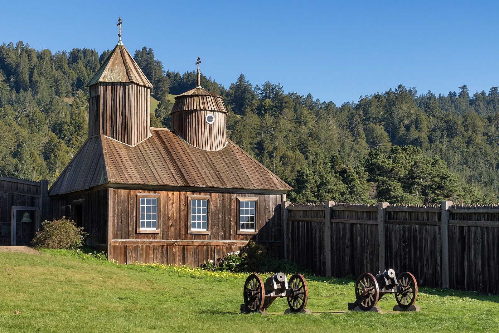
Eleven miles north of Jenner stands a wooden stockade built in 1812 by the Russian-American Company, the southernmost Russian outpost in North America. Inside are the reconstructed chapel, the Rotchev House (the only original building) and blockhouses with cannon; outside is a windswept bluff, a cove where sea otters were once hunted to the brink, and a visitor center with one of the best museum exhibits on the north coast. Allow two hours; day use is $10 per vehicle. Living-history days with costumed interpreters happen several times a year.
Back in Jenner, the visitor center in the old boathouse has displays on the estuary, the Kashia Pomo people whose homeland this is, and the lumber mill and ferry that gave the village its start. The current Highway 1 bridge over the river dates from 1931.
Scenic drives, small towns and a glass of wine
Highway 1 north: the Jenner Grade
The most dramatic stretch of Highway 1 in Sonoma County climbs 600 feet straight out of Jenner on a cliff edge, with pullouts every half mile. Drive it slowly, pull over to let locals pass, and do not do it in thick fog if you can help it. Meyers Grade Road at the top is the inland shortcut back.
Fort Ross–Seaview wine country
The ridges above Fort Ross grow some of California's most prized cool-climate Pinot Noir and Chardonnay. Fort Ross Vineyard's tasting room sits on a hilltop with ocean views; tastings are by reservation, so book before you drive up. Designate a driver: the roads are narrow and the return trip is the Jenner Grade.
Duncans Mills
A one-street 1870s railroad town with a general store, a handful of shops and galleries, two good cafés and a riverside campground with a beach. The best place near Jenner for coffee and a pastry on the way to the coast.
Bodega Bay and Bodega Head
Working fishing harbor, crab shacks, the Spud Point Marina and, out at the end of the peninsula, Bodega Head: a short loop trail on the bluff and the region's best whale-watching perch. Hitchcock filmed The Birds in the village of Bodega just inland.
Guerneville and the Russian River Valley
The river town: swimming beaches at Johnson's Beach, canoe trips, restaurants, bars and dozens of wineries along River Road and Westside Road. Also the nearest gas, groceries and pharmacy to Jenner.
Stargazing
With no town lights for miles, a clear fall or winter night on the Goat Rock road or at the Vista Trail lot shows the Milky Way properly. Check the fog forecast first.
Armstrong Redwoods
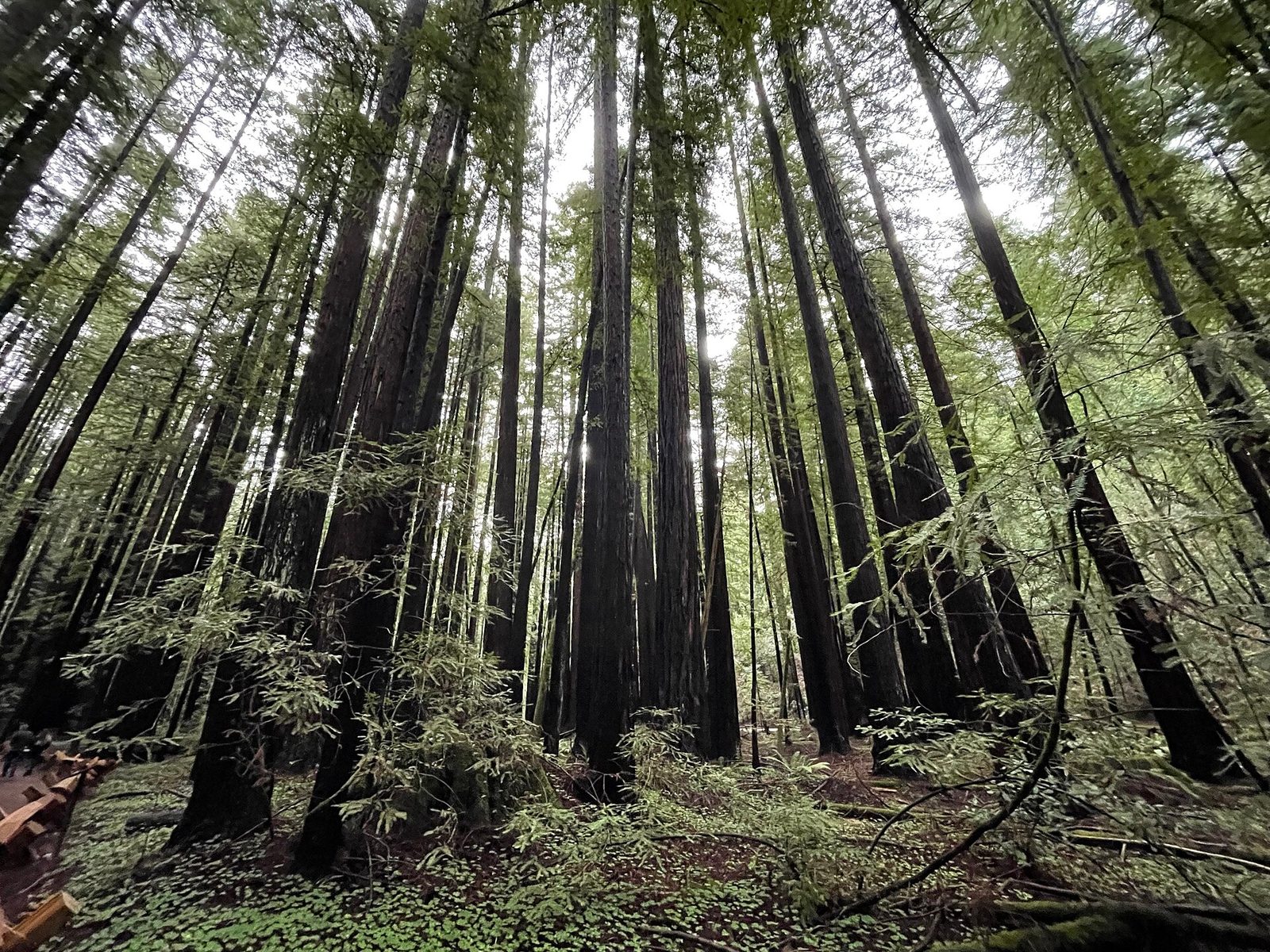
Twenty minutes inland, just north of Guerneville, Armstrong Redwoods State Natural Reserve is a cathedral of old-growth coast redwoods on a flat, shaded valley floor. The Pioneer Nature Trail from the entrance to the Colonel Armstrong Tree (over 1,400 years old and more than 300 feet tall) is an easy half-hour walk on a flat, wheelchair-accessible path. Day use is $10 per vehicle. Austin Creek State Recreation Area above it has the longer, hotter hikes.
It is the perfect answer to a foggy coast morning: the fog usually burns off over the redwoods first.
Where to watch the sunset
Jenner faces due west across the river mouth, so almost anywhere works. These are the local picks:
River's End deck
Dinner or a drink on the bluff above the mouth, looking straight at Goat Rock. Book ahead for a window table on weekends.
Goat Rock parking lot
Park, walk to the edge, and watch the light go pink on the sea stacks with the seals barking below. Free and unbeatable.
Highway 1 pullouts
The first two pullouts on the Jenner Grade north of town look down on the whole estuary. Bring a jacket; the wind is strong up there.
Jenner Headlands overlook
The short walk from the preserve parking lot to the first bench. Afterwards it is a five-minute drive back down to town for dinner.